Site History
|
The Grand Calumet River has long been recognized as one of the most contaminated rivers in the nation. With a history rich in steelmaking, meatpacking, and oil refining, a cocktail of heavy metals, PCBs, PAHs, NAPL, and oil and grease was discharged into the river before modern environmental controls were established. Water quality is still challenged by pollution from combined sewer overflows, non-point sources, and industrial discharges, but the sources responsible for sediment contamination are mostly a thing of the past. And concerted efforts to clean up the river are making it closer than ever to becoming safe for people, fish, and wildlife to use and enjoy.
Since 2009, more than 2 million cubic yards of contaminated sediment have been dredged or capped in the 13-mile Grand Calumet River system under the Great Lakes Legacy Act (GLLA). Acres of wetland have been restored with native trees, grasses, and other plants, providing food and shelter to local fish and wildlife. The Lake George Canal Middle & East section of the Grand Calumet River has completed the design stage, and is ready for cleanup. |
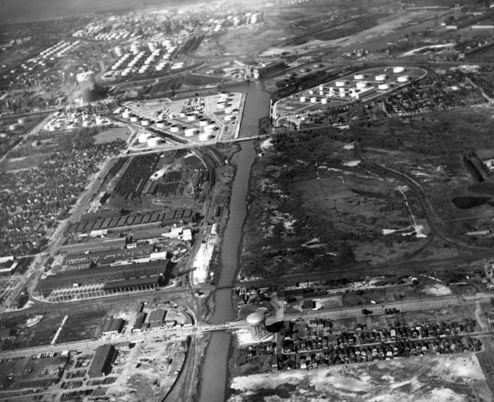
The Grand Calumet River has been a hub for Great Lakes commerce for over a century.
|
Location
The Lake George Canal Middle & East project is located #9 on the map. The project is located in the Grand Calumet River Area of Concern, whose entire system flows through the northwest Indiana towns of Hammond, East Chicago, and Gary.
Cleanup Process |
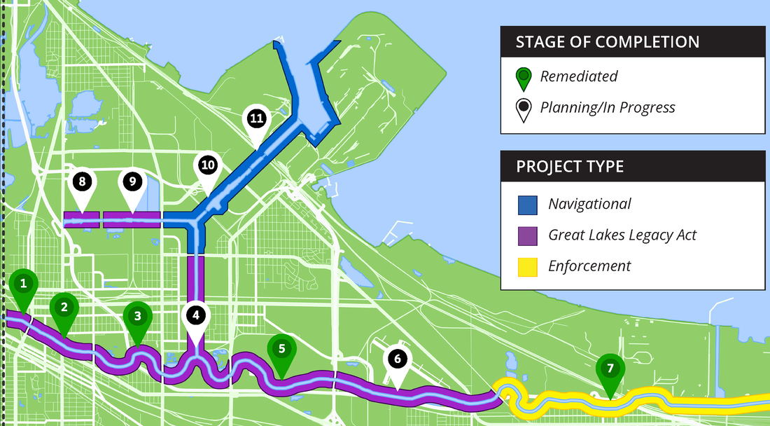
ScheduleThe Lake George Canal Middle & East project design is complete and the project team is working toward cleanup.
|
Long-term Benefits
- A cleanup would remove contamination from the food chain, lowering exposure for those who eat fish from the Great Lakes and helping to bring back fish populations in the Grand Calumet River.
- Any improvements to habitat and shoreline could help landscape views and provide better food and shelter for fish and wildlife.
- Government investment into waterways can often result in community reinvestment, leading to economic development.
To learn more about the significant benefits enjoyed by communities in Areas of Concern watch the Great Lakes Legacy Act video.
Community Involvement
The Grand Calumet River is not commonly thought of as a recreational destination. Buildings were designed long ago to have their backs to the river, and most citizens are not even aware that a river runs through their community. Despite all of these setbacks, a group of local residents have steadily advocated for the river to be cleaned and its habitat restored. For decades, they operated as the Grand Calumet Task Force and performed outreach with their congressional representatives, local officials, and neighbors to bring attention to the river. Locals have since partnered with agencies and helped bring about the cleanup and restoration of approximately 10 miles of river. Contact Natalie Mills, (312) 846-5561, to provide input on the project or ask questions.
June 25, 2015 public meeting at East Chicago Library
More Information
Documents and Resources
Lake George Branch-Middle Section Fact Sheet (PDF, 2p, 1.5MB) February 2022
East Chicago Waterways Design fact sheet (PDF, 4p, 3.4 MB) May 2016
Feasibility Study for East Chicago Waterway Management District (PDF, 100p, 7.8 MB) June 2015
Grand Calumet River Area of Concern habitat report (PDF, 21p, 649KB) March 2014
Grand Calumet River FAQs (PDF, 12p, 5 MB) June 2013
Stakeholders
The Nature Conservancy
Shirley Heinze Land Trust
Save the Dunes
East Chicago Waterway Management District
IN Department of Environmental Management Area of Concern
IN Department of Natural Resources
EPA Great Lakes Legacy Act Grand Calumet River
Army Corps of Engineers Indiana Harbor Dredging
The Nature Conservancy
Shirley Heinze Land Trust
Save the Dunes
East Chicago Waterway Management District
IN Department of Environmental Management Area of Concern
IN Department of Natural Resources
EPA Great Lakes Legacy Act Grand Calumet River
Army Corps of Engineers Indiana Harbor Dredging