The city contributed to the legacy contamination in Howards Bay, so the city will be part of the solution.
That’s a big part of why we’re a partner in the project.
- Darienne McNamara, City of Superior, 2020 public meeting
Site History
|
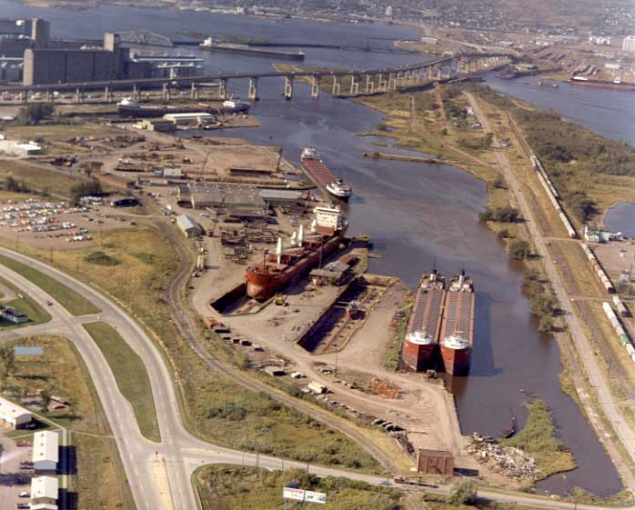
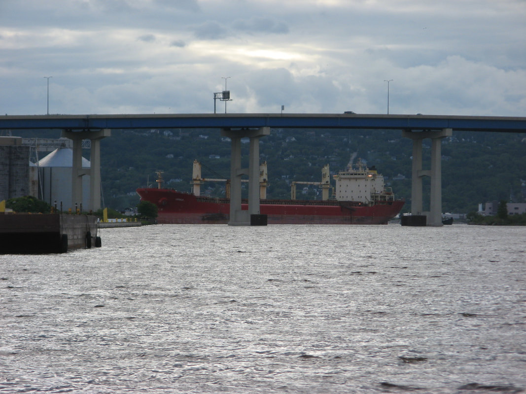
Howards Bay is an industrially active area in the lower estuary of the St. Louis River, rich with a history in shipyards, grain terminals, and commercial shipping. Before modern-day environmental regulations, common practices led to a buildup of contamination in the sediment at the bottom of the bay. This resulted in damage to the underwater habitat and negative impacts to the food chain. The contamination has made routine dredging impractical, making it difficult for large vessels to access the bay.
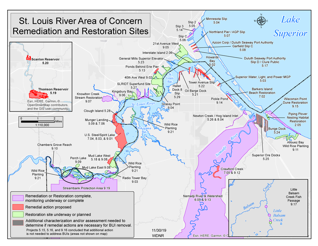
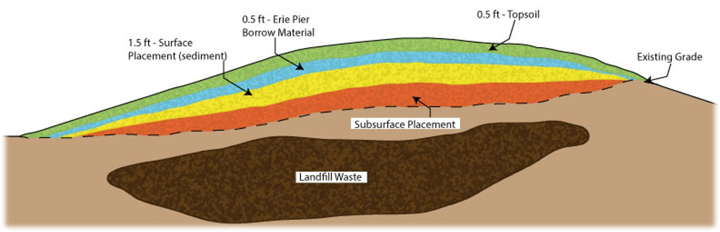
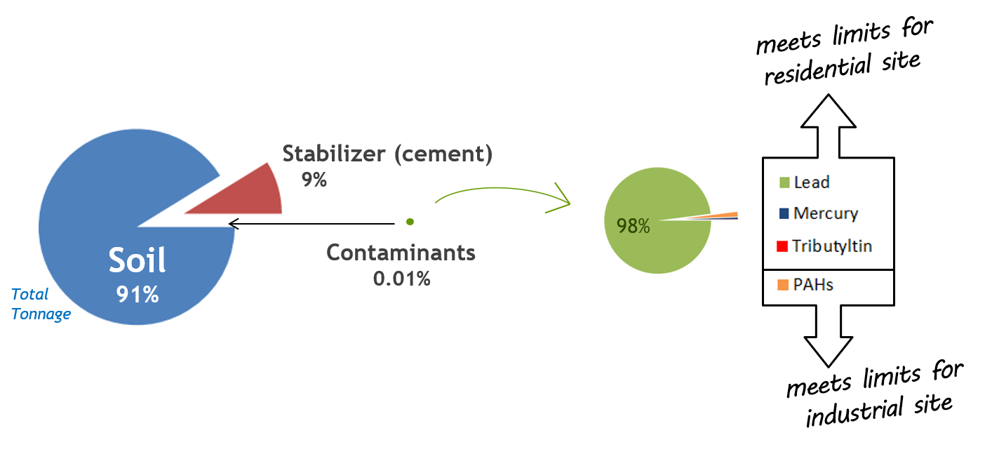
Howards Bay is the largest contaminated site in Wisconsin in the St. Louis River Area of Concern. Investigations reveal that the sediment is contaminated with lead, PAHs, mercury, and tributyltin. A voluntary, public-private partnership has formed under the Great Lakes Legacy Act to address contamination. The project team is currently working on the design. A project agreement for cleanup has been signed, and a cleanup will likely take place in 2020-2021. The dredged material is destined for Wisconsin Point. |
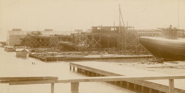
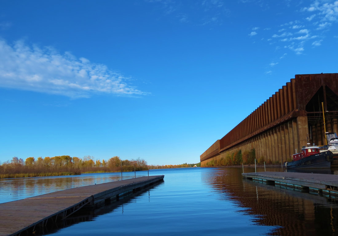
The shipyards in Howards Bay were busiest during wartime (Credit: Fraser Shipyards).
|

Location
|
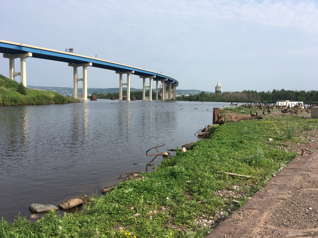
Howards Bay is located next to Connor's Point in Superior, WI and is bisected by Interstate 535. The site is in the lower estuary of the St. Louis River, which is the largest Great Lakes Area of Concern in the United States.
|
|
ScheduleThe project team is currently completing the design. A project agreement for cleanup has been signed, and a cleanup will likely take place in 2020-2021.
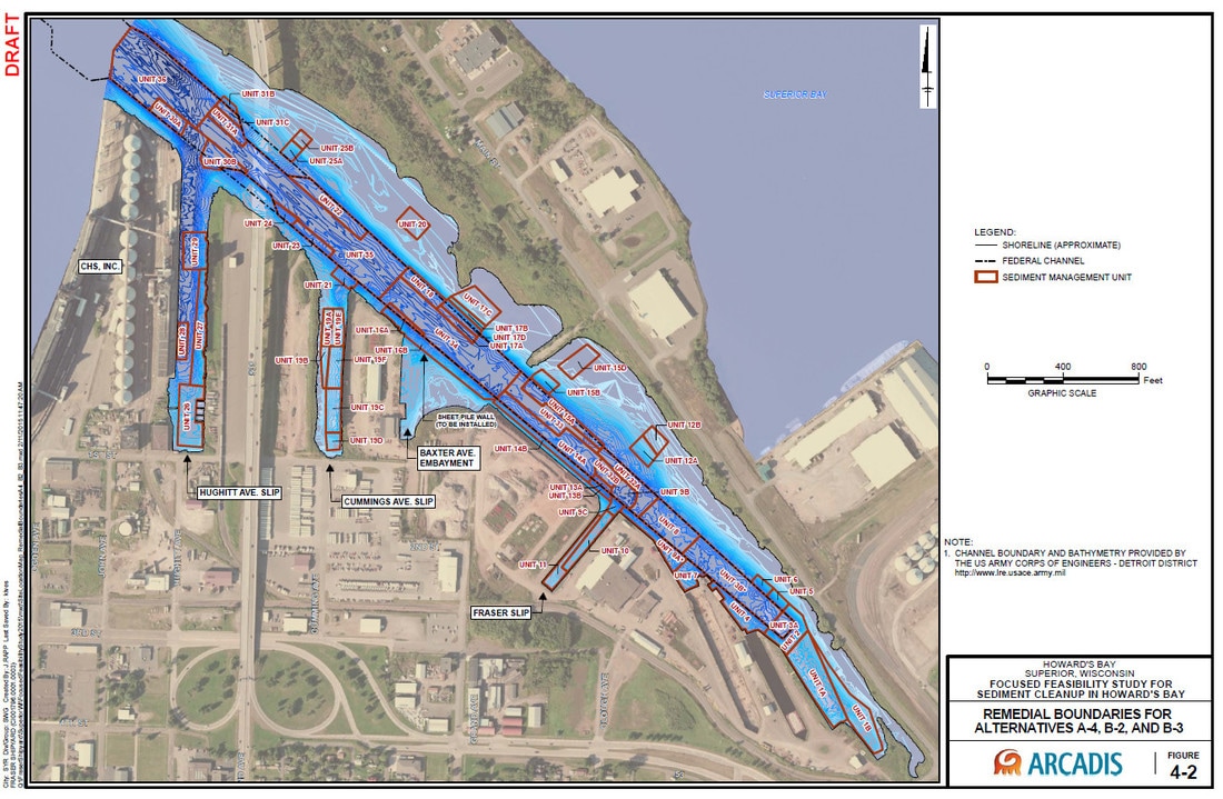
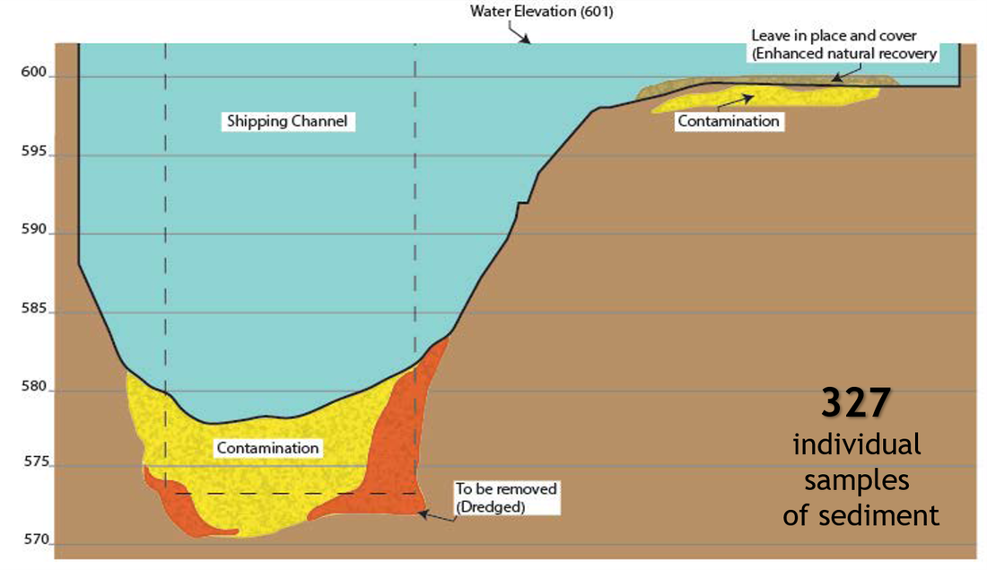
Cleanup ProcessSediment to be remediated: 87,000 cubic yards
Contaminants: Lead, PAHs, mercury, and tributyltin Method: Dredging and sand cover When: as early as 2020 Partners: U. S. Environmental Protection Agency, Wisconsin Department of Natural Resources, City of Superior, and Fraser Shipyards Cost: $18 million |
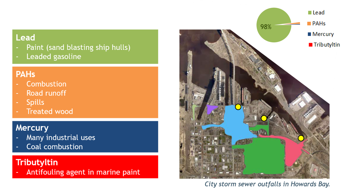
The bars on the left show where the contaminants come from. The pie chart in the top right shows the weight of the contaminants compared to each other. The three yellow dots on the map show locations of city storm sewers.
|
Click gallery images to enlarge.
Short-term Disruptions
Sediment remediation is like a construction project on the water. It can involve large equipment, bright lights, and noise. Many projects even continue into the night and on weekends to speed up the process. Remediation can feel inconvenient, but a bit of patience results in a big payoff.
Long-term Benefits
|
|
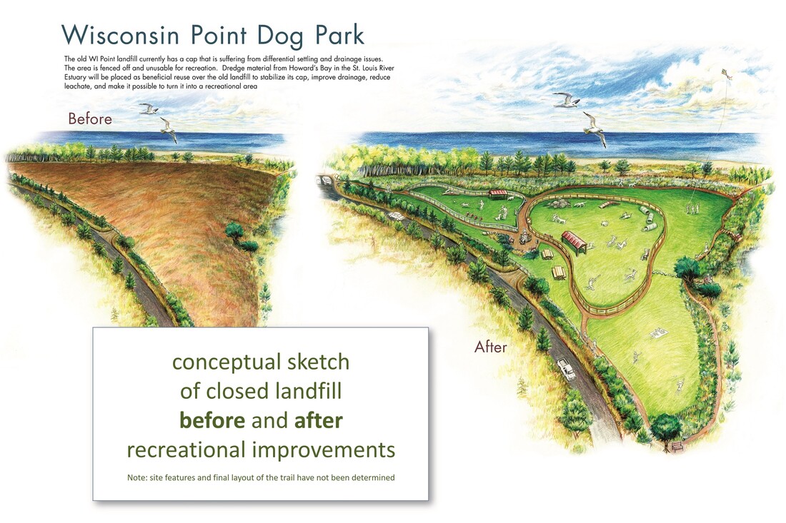
Wisconsin Point conceptual sketch (Image credit: City of Superior)
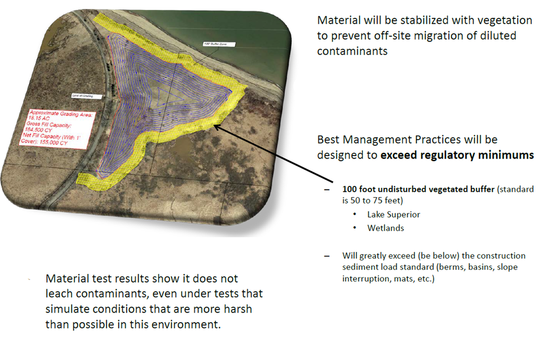
Upon completion of the dredge project, the closed landfill will be converted into a new recreational area as proposed in the Wisconsin Point Area Management Plan. It will feature native pollinator-friendly plants, mowed walking paths, and benches. Due to the buried waste and limitations related to the dredge material, some uses would be restricted.
- Increased footpath access
- Development of unpaved paths or trails
- Development of pet-friendly activities such as a fenced, off-lead play area
- Improving public parking and access to the site
- Creation of an access linkage between parking lot 1 and the closed landfill site
- Development of signage relative to access and use limitations
Community Involvement
|
Howards Bay may feel a bit tucked away from the everyday bustle of community life, but cleanup actions will have far-reaching impacts on the larger estuarine environment, as well as the local economy of Superior. Contact U. S. EPA project manager, Diana Mally, to provide input on the project, ask questions, or to coordinate the project with community events near the site.
March 3, 2020 City of Superior public meeting
March 14-15, 2017 St. Louis River Summit at UW-Superior Campus
January 24, 2017 Public meeting at City of Superior Government Center
|
A calm day at a local boat ramp, Loon’s Foot Landing, provides access to the St. Louis River estuary. (Photo credit: City of Superior)
|
More Information
Documents and Resources
Howards Bay fact sheet (PDF, 2p, 4 MB) March 2020
Dredged Material Management Options Evaluation (PDF, 1p, 206KB) January 2017
Howards Bay Contaminants Fact Sheet (PDF, 1p, 1.1MB) January 2017
Public Meeting Brochure (PDF, 2p, 1.1MB) January 2017
Focused Feasibility Study for Sediment Cleanup in Howards Bay (PDF, 116p, 38.5MB) July 2015
Stakeholders
St. Louis River Alliance
Lake Superior National Estuarine Research Reserve
Fond du Lac Band
City of Superior
Fraser Shipyards
Wisconsin and Minnesota Sea Grant (St. Louis River - Stories and Science)
Wisconsin Department of Natural Resources
U. S. Environmental Protection Agency