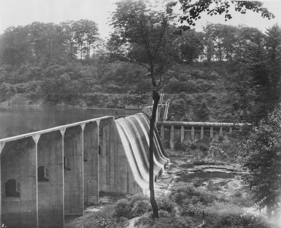
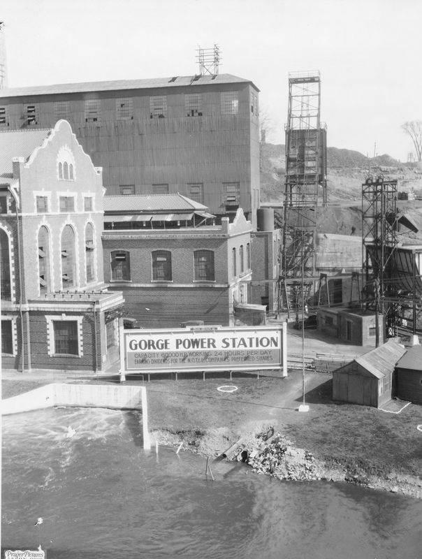
Site HistoryThe Gorge Dam was constructed in 1913 by Northern Traction & Light – which later became Ohio Edison. It operated as a hydroelectric power plant until 1958. The reservoir behind the dam provided cooling water for a coal power plant until 1992. The power plant has been dismantled, but the dam remains.
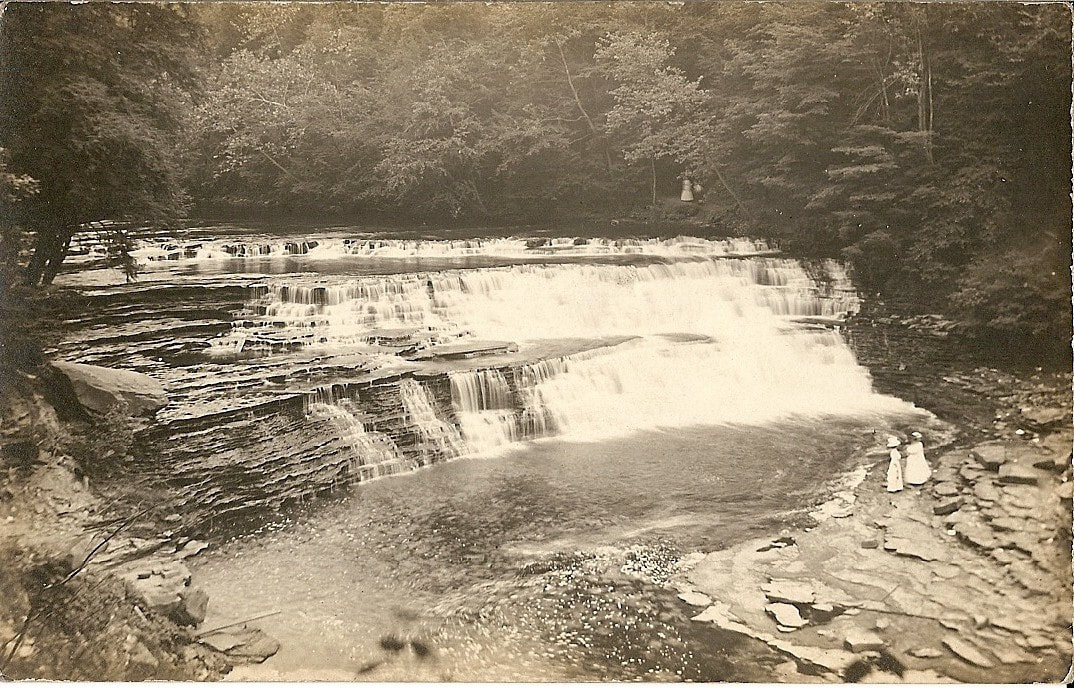
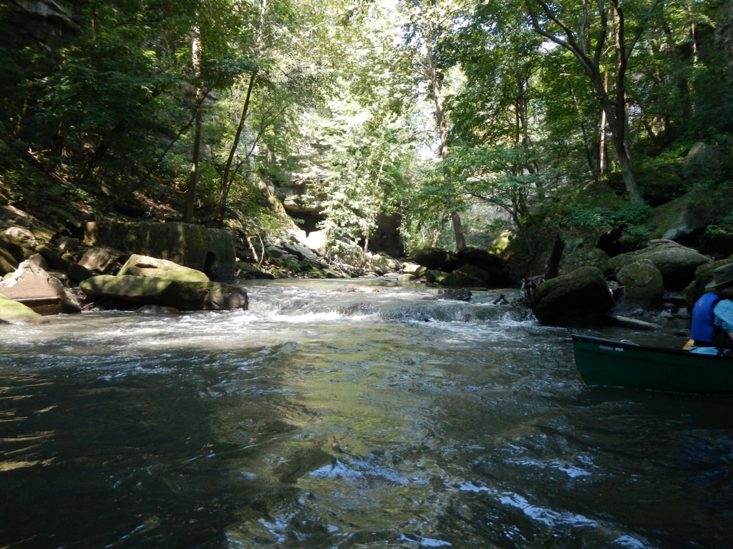
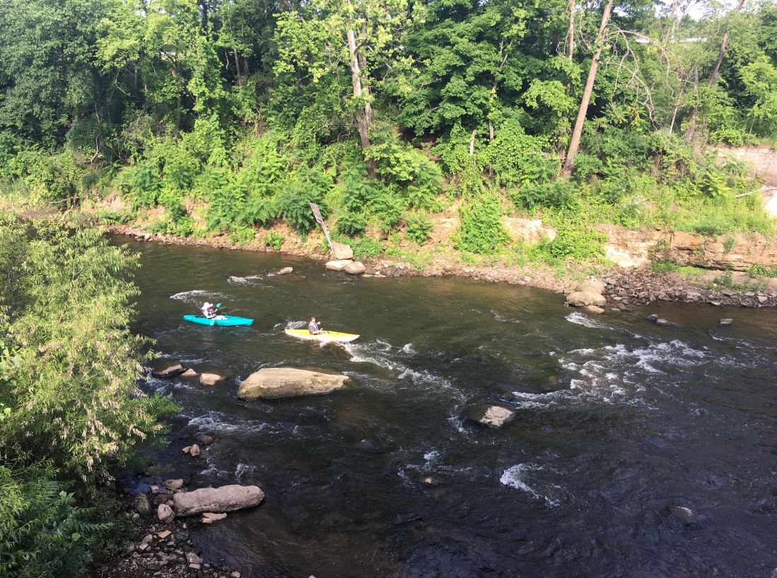
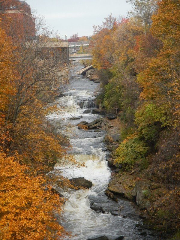
Remarkable geology surrounds the dam, with the Cuyahoga River dropping 200 feet in elevation in less than two miles. The dam interrupts the potential for 2.5 miles of continuous Class III – Class V whitewater. Summit Metro Parks sponsors kayak trips in the pool, although it is closed for swimming. The dam lies within the Cuyahoga River Area of Concern and is the major source of water quality problems on this section of river. About 832,000 cubic yards of contaminated sediment are trapped in the reservoir behind the dam. In concert with ongoing restoration efforts, the remediation of this site will restore beneficial uses of the river to the communities of Northeast Ohio, facilitate fish movement, and increase habitat quality. |
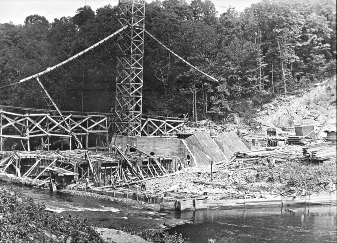
Construction of the dam in the early 1910s (Photo Credit: Summit Metro Parks)
|

Location
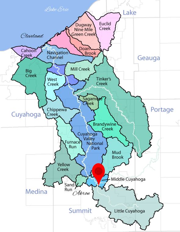
The Gorge Dam is situated on the Cuyahoga River in Gorge Metro Park, which offers 1,700 acres of contiguous green space in Summit County. The dam is in Cuyahoga Falls, OH and near Akron, OH. The dam lies within the Cuyahoga River Area of Concern.
|

U. S. EPA's vessel, the RV Mudpuppy, samples sediment in the Gorge Dam pool. (Photo Credit: Elaine Marsh, Summit Metro Parks)
|
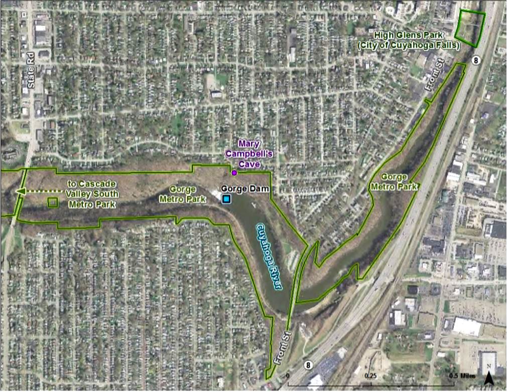
Aerial image of Gorge Metro Park and surrounding properties (Photo Credit: Summit Metro Parks)
|
Cleanup Process |
Schedule |
|
Sediment to be remediated: 832,000 cubic yards
Contaminants: PAHs, PCBs, heavy metals, oil and grease, and pesticides Method: Dredging and Dam Demolition When: TBD Partners: U. S. Environmental Protection Agency and Ohio EPA with funding from City of Akron Cost: TBD |
The Ohio EPA and U. S. EPA have signed a cooperative project agreement, and a remedial design is taking place. Funding has been approved through the Great Lakes Legacy Act with cost-share provided by the City of Akron. More updates will be provided as the project progresses.
|
|
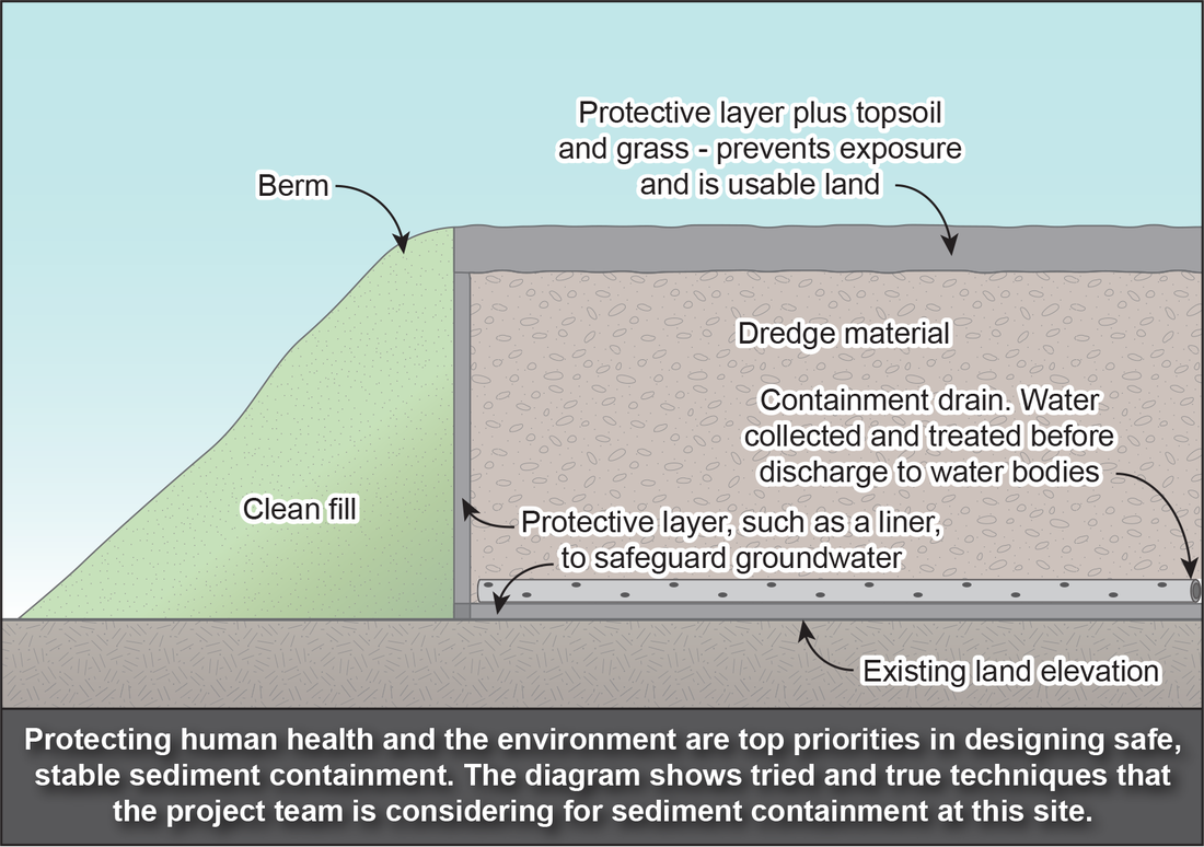
Sediment removed from the Gorge Dam pool will need permanent containment. No decisions have been finalized about where, but preliminary considerations are to place dredged sediment in an area within Cascade Valley Metro Park. The City of Akron-owned site was formerly used illegally as a dumping ground. It is located outside the 100-year floodplain.
The project team is reviewing a number of tried and true techniques for sediment containment to protect water quality and human health (see diagram). The intention is to design the containment area so that in the future, the land is usable in a variety of ways, including recreation. |
Short-term Disruptions
Gorge Metro Park is a destination for local hikers, anglers, bird watchers, and more. The dominant land use type around the park is residential. This will be taken into account in the remedial design plan, and efforts will be made to minimize impact on local activities. Sediment remediation is like a construction project on the water. It can involve large equipment, bright lights, and noise. Many projects even continue into the night and on weekends to speed up the process. Remediation can feel inconvenient, but a bit of patience results in a big payoff.
Long-term Benefits
A cleanup at the Cuyahoga Gorge Dam would contribute to the efforts to restore the Cuyahoga River Area of Concern. In addition to continuing the overall restoration work in the Area of Concern, a remedial project would provide other long-term benefits:
|
|
Community Involvement
This stretch of the Cuyahoga River is an asset for many nearby Ohio communities. Local residents have been long anticipating the removal of the Cuyahoga Gorge Dam. There is continued strong interest in the restoration of the river, particularly given the upcoming 50th anniversary of the 1969 Cuyahoga River fire. In September 2016, a technical advisory group called the Gorge Dam Removal Stakeholder Committee was established. It is facilitated by Summit Metro Parks, and members include City of Akron, City of Cuyahoga Falls, County of Summit, First Energy, Ohio EPA, Summit County Council, Summit Metro Parks, and U. S. EPA. Contact U. S. EPA project manager Mary Beth Giancarlo to provide input on the project, ask questions, or help coordinate the project with community events on the river. On the local level, contact Elaine Marsh at Summit Metro Parks.
|
|
April 9, 2019 public meeting
|
Cultural Resources
Archaeological and historic resources in the project area are being assessed pursuant to Section 106 of the National Historic Preservation Act of 1966 (NHPA) (codified as CFR 800), which requires federal agencies to take into account effects of an undertaking on historic properties. Historic properties are any prehistoric or historic districts, sites, buildings, structures, or objects that are eligible for or already listed in the National Register of Historic Places.
Learn more about the cultural resources in and around the Gorge:
PowerPoint
Historic Photos
Public involvement is part of the process! We invite your comments on the effects this project may have on historic properties (archaeological or historical sites, structures, or features). Comments can be made via:
Online form: https://www.surveymonkey.com/r/YSJ3RYV
Email: [email protected]
Mail using comment form: Megan Shaeffer, Cultural Resources Supervisor, 975 Treaty Line Rd., Akron, OH 44313
More Information
Documents and Resources
Cuyahoga Gorge Dam data gaps assessment (PDF, 10p, 1.5MB) March 2019
Feasibility Study for the Removal of the Gorge Dam (PDF, 66p, 5MB) September 2015
Stakeholders
Summit Metro Parks
City of Akron
City of Cuyahoga Falls
Cuyahoga River Restoration
Friends of the Crooked River
Cuyahoga Valley National Park
Ohio Environmental Protection Agency
U. S. Environmental Protection Agency