The sediment cleanup of Minnesota Slip is complete!
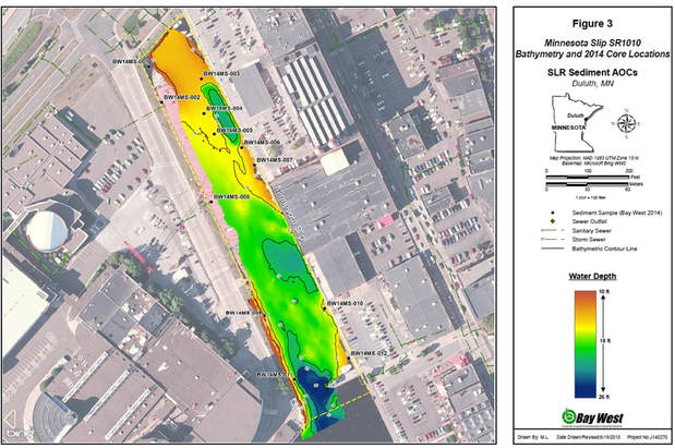
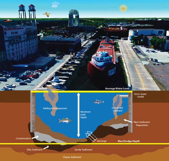
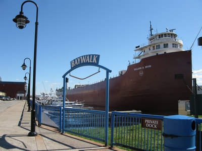
In fall 2018, 37,000 cubic yards of contaminated sediment were remediated in Minnesota Slip. To do so, 2,500 cubic yards of sediment were moved around on the slip's bottom to make it level. Two feet of clean sediment dredged from other areas of the harbor were added to the slip, along with armoring stone to protect the cap from boat traffic. But first, the dock walls in Minnesota Slip had to be repaired to prevent erosion into Minnesota Slip and ensure safety during the cleanup. And of course, the William A. Irvin was moved outside of the slip so that the crew could access the contaminated sediment. The Irvin will return in the spring. This project was performed voluntarily under the Great Lakes Legacy Act.
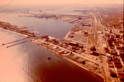
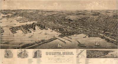
The Port of Duluth-Superior is one of the largest ports on the Great Lakes. It has long been a center for trading and became open to commercial shipping traffic in 1896. The port, situated within the St. Louis River estuary, remains a hub for commerce including grain, iron-ore, and coal. The area contains multiple slips where large vessels can load, unload, or dock. Arguably the most visible of these slips is Minnesota Slip, which is located near the downtown Duluth waterfront.
The Port of Duluth-Superior is one of the largest ports on the Great Lakes. It has long been a center for trading and became open to commercial shipping traffic in 1896. The port, situated within the St. Louis River estuary, remains a hub for commerce including grain, iron-ore, and coal. The area contains multiple slips where large vessels can load, unload, or dock. Arguably the most visible of these slips is Minnesota Slip, which is located near the downtown Duluth waterfront.
Location
|
Minnesota Slip is located in Duluth, MN and is within the St. Louis River Area of Concern. The slip is between the Duluth Entertainment Convention Center and Canal Park, where the William A. Irvin museum is docked.
|
Cleanup ProcessSediment remediated: 37,000 cubic yards
Contaminants: Heavy Metals, PAHs Method: Capping When: 2018 Partners: U. S. Environmental Protection Agency and Minnesota Pollution Control Agency Cost: $3 Million Note: 2,500 cubic yards of contaminated sediment were moved to level the slip and to allow for its current use to continue. A two foot thick cap with armoring stone was placed in the slip to protect the cap from boat traffic. Long-term Benefits
|
More Information
Documents and Resources
Great Lakes Areas of Concern: Six Strategies to Support Community Revitalization (PDF, 8p, 987KB) 2024
Duluth’s Revitalization: The St. Louis River Area of Concern (video, 5:20), 2022
Minnesota Slip fact sheet (PDF, 2p, 646KB) September 2018
Minnesota Slip focused feasibility study (PDF, 186p, 6.1MB) June 2014
St. Louis River Area of Concern remedial action plan update (PDF, 78p, 1.79MB) July 2013
Stakeholders and Resources
St. Louis River Alliance
City of Duluth
Wisconsin and Minnesota Sea Grant St. Louis River - Stories and Science
Minnesota Pollution Control Agency
Minnesota Department of Health Fish Consumption Guidance
Wisconsin Department of Natural Resources Area of Concern
U. S. Environmental Protection Agency
